Glyndon MN Pole Barn Builders | Post-Frame Shops & Farm Buildings
Post-frame buildings in Glyndon and the surrounding Clay County townships, designed to Minnesota loads and the state's mandatory building code. Sitting on the transition between the lakebed and the beach ridge means more fall for drainage and less uniform bearing under the footings. Fargo ND Pole Barn Builders also builds across the rest of Cass County, North Dakota and Clay County, Minnesota.
Get a quote on your building
Tell us the size, the use and where the site is. We will come back with a scope and a price, not a brochure.
Glyndon MN Pole Barn Builders
Where the valley floor starts to lift toward the beach ridge
Glyndon was founded in 1872 and named after Howard Glyndon, the pen name of the poet Laura C. Redden Searing. It sits on US Route 10 east of Moorhead at an elevation of about 922 feet, which puts it noticeably higher than the valley floor at Harwood and noticeably lower than Barnesville on the beach ridge.
The town calls itself the gateway to Buffalo River State Park, and that proximity to the Buffalo River is worth knowing about because Clay County's Shoreland rules apply within 300 feet of any river or stream.
Before a Glyndon build
Four checks, two of which have permit consequences.
- Identify your zoning district
Clay County Planning on 218-299-5005 or the online zoning map will tell you from the parcel. Over 90 percent of the county is Agricultural General, but the exceptions matter.
- Confirm Shoreland status
Glyndon sits close to the Buffalo River and Shoreland applies within 300 feet of any river or stream, bringing setbacks, impervious surface limits and vegetation rules.
- Estimate the fill volume
A Land Alteration Permit is required above 50 cubic yards outside steep slopes and shore-impact zones, and a raised pad can reach that without anyone thinking about it.
- Decide whether the building is heated
Minnesota's energy code applies where it applies, and it sets a meaningfully higher envelope bar than an unregulated farm shed across the river.
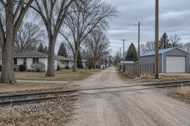
Glyndon sits at the transition between the flat lakebed of the valley floor and the rising ground toward the glacial beach ridges to the east. That thirty-odd feet of elevation over Harwood does not sound like much and it makes a real difference to drainage, because there is finally some fall to work with.
The soils also start to change as you move east from the river. The pure heavy lakebed clay of the valley floor gives way gradually to more variable material, which means bearing conditions become less predictable and worth checking in each bore rather than assuming from the first.
Thirty feet of elevation changes the conversation
Glyndon sits at about 922 feet, against roughly 889 feet at Harwood on the bottomland and about 1,030 feet at Barnesville up on the beach ridge. That puts it on the transition between the flat lakebed and the rising ground to the east. Practically, it means there is finally some fall to work with for drainage, and it also means the soils become less uniform, so bearing gets checked in every bore rather than extrapolated from the first.
How we build in Glyndon
- Clay County snow load applied
50 psf under Minnesota Rules 1303.1700, higher than the Cass County figure.
- Shoreland district checked
Within 300 feet of a river or stream, Clay County's Shoreland provisions add setbacks and impervious surface limits.
- Minnesota code compliance
Mandatory statewide, with no local opt-out.
- Land Alteration Permit assessed
Required for moving more than 50 cubic yards of material, which pad work can exceed.
What we build around Glyndon
A mix of small-town residential and township agricultural.
- Detached garages and shops in town
On lots that are generally more generous than Dilworth's, permitted through the city.
- Heated shops on acreages
With Minnesota's energy code applying to the envelope, which sets a higher bar than an unregulated farm shed would.
- Agricultural buildings in the townships
Standard farm building work on Agricultural General ground, which is most of the county.
- Buildings near the Buffalo River
Where the Shoreland provisions bring setbacks, impervious surface limits and vegetation rules into the siting decision.
Local conditions and figures
Clay County's zoning structure is straightforward once you know it. Over 90 percent of the county is zoned Agricultural General. Agricultural Service Center districts cover the small unincorporated communities. Urban Expansion Tiers 1 and 2 extend roughly two miles around Moorhead and Dilworth, and lakes, rivers and streams carry Shoreland zoning.
For a Glyndon property, working out which of those applies is quick, and the Clay County Planning Office at 218-299-5005 or the online zoning map will tell you. It is worth doing before you settle on a building position.
The transition ground east of the river also means the water table behaves differently from parcel to parcel, sometimes noticeably so within a single quarter section. A neighbour's experience of what they found when they dug is useful local knowledge and it is not a substitute for checking your own bores. We inspect the bottom of each hole here as a matter of routine rather than as an exception.
How a Glyndon build runs
- Step 01Zoning and Shoreland check
District established through Clay County Planning or the city, with Shoreland status confirmed.
- Step 02Design to Minnesota loads
50 psf ground snow load, plus energy code compliance where the building is heated.
- Step 03Permits
Building permit, plus a Land Alteration Permit where pad work exceeds the volume threshold.
- Step 04Build
Footings to 60 inches, frame, envelope and finish, with inspections through.
Questions we get asked in Glyndon
What snow load applies in Glyndon?
50 psf ground snow load, because Clay County falls into the 50 psf group under Minnesota Rules 1303.1700. That is 25 percent higher than the Cass County figure a few miles west, and the trusses are designed accordingly.
Do Shoreland rules apply to my property?
They do if you are within 300 feet of a river or stream, or 1,000 feet of a lake. Given Glyndon's proximity to the Buffalo River, it is worth checking with Clay County Planning rather than assuming. Shoreland brings setbacks, impervious surface limits and vegetation clearing standards.
Will pad work need a Land Alteration Permit?
Possibly. Clay County requires one for moving more than 50 cubic yards of material outside steep slopes and shore-impact zones, and more than 10 cubic yards within them. Building a raised pad can exceed that threshold, so we check before moving material.
Is the ground different here from Moorhead?
Somewhat. Glyndon sits about thirty feet higher than the valley floor near the river and the soils become more variable as you move east toward the beach ridges. There is more fall to work with for drainage, and bearing conditions are less uniform.
Does Minnesota's energy code apply to a heated shop?
Where the building is heated and the code applies to it, yes, and it is a meaningfully higher bar than an unregulated agricultural shed in North Dakota. We design the envelope to comply rather than discovering it at inspection.
Do you charge for a Glyndon quote?
Yes, quotes and site visits are free throughout Clay County.
Does being near Buffalo River State Park affect building?
Proximity to the park itself is less relevant than proximity to the river. Clay County's Shoreland provisions apply within 300 feet of a river or stream and bring setbacks, impervious surface limits and vegetation clearing standards with them. Given where Glyndon sits, it is worth confirming with the county rather than assuming a parcel is clear of it.
Will a Glyndon project need county involvement as well as city?
It can. The city issues permits inside its boundary, but Shoreland provisions apply within 300 feet of a river or stream and are administered at county level, and a Land Alteration Permit for pad work comes from Clay County Planning and Zoning regardless of which city you are in. Given the Buffalo River, both are worth checking here.
Everything we build in Glyndon
All of it is available in Glyndon and the Clay County townships around it, designed to Minnesota loads and the state energy code where the building is heated.
- Agricultural Pole Barns
- Horse Barns & Equestrian Buildings
- Machine Sheds & Equipment Storage
- Livestock Barns
- Hay Storage Buildings
- Pole Barn Garages
- RV & Boat Storage Pole Barns
- Pole Barn Workshops
- Commercial Pole Barns
- Hobby Shops & Man Cave Pole Barns
- Pole Barn Construction
- Pole Barn Design & Planning
- Pole Barn Foundation & Concrete Work
- Pole Barn Framing
- Pole Barn Roofing Installation
- Pole Barn Siding Installation
- Pole Barn Electrical Rough-In
- Pole Barn Insulation Installation
- Pole Barn Repair
- Pole Barn Renovation & Additions
- Post-Frame Building Construction
- Insulated Pole Barns
- Pole Barns with Living Quarters (Barndominiums)
- Custom Pole Barn Doors & Windows
- Pole Barn Loft & Second-Story Additions
- Metal Roof Pole Barns
- Wood-Sided Pole Barns
- Pole Barn Ventilation Systems
- Pole Barn Site Prep & Grading
- Pole Barn Snow Load Reinforcement
Building around Glyndon
Give us the parcel and we will check the zoning district and whether Shoreland rules apply before designing.